Murphy, NC Historical Sites Beckon Modern Visitors

If you’re a confirmed North Carolina history buff, downtown Murphy, NC features several noteworthy historical sites, most of them just a stone’s throw from the town’s center square.

Cherokee County Courthouse

Let’s say you came downtown for some coffee and pastries from The Daily Grind; or maybe you just finished a tasty lunch at Shoebootie’s. To walk off those calories, and satisfy your appetite for history, stroll up Peachtree Street to the Cherokee County Courthouse. You can’t miss it – just look for the huge marble building on the corner, next to Smoky Mountain Shooters Supply.

This Courthouse was built entirely of blue marble from – you guessed it – the nearby Marble community. The current Courthouse opened for business in 1927, after a fire destroyed the supposedly fireproof brick courthouse the year before. If you enjoy tracking down National Register of Historic Places landmarks, the Cherokee County Courthouse has a spot on that coveted list.

Cherokee County Historical Museum

Just steps from the Courthouse, step into the Cherokee County Historical Museum. Inside this brick building, kids will enjoy shiny minerals and quartz crystals, plus colorful rubies and amethysts. They might also imagine using the early settlers’ tools to accomplish everyday household and farm chores.

Of course, the Cherokee Indians have been longtime residents here, on a huge expanse of farmland and forests called the Cherokee Nation. To honor their culture, the Museum showcases over 2,000 Cherokee Indian artifacts. Besides typical household items, you’ll see plenty of pottery, axes, pipes, game stones, and arrowheads.

As a side note, nearby Fort Butler served as a collection point for Cherokee Indians made to march on the “Trail of Tears” to Oklahoma. During 1837, over 3,000 Cherokees from North Carolina and Georgia passed through the fort before their long journey west. Look for the memorial monument on nearby Fort Butler Street.

Harshaw Chapel and Cemetery

Next, take a jaunt to Central and Church Streets, an easy hike in good walking shoes. Here, you’ll find historic Harshaw Chapel and Cemetery, both occupying spots on the National Register of Historic Places. Well-known Murphy resident Joshua Harshaw dedicated this brick chapel to the Methodist Episcopal Church in 1869, although its adjacent cemetery was in operation before that.

The Harshaw Chapel was actively used for about 60 years, but deteriorated after the First United Methodist Church was built to accommodate the area’s growing Methodist congregation. In 1965, the Daughters of the American Revolution (Archibald D. Murphey chapter) acquired the chapel, and they’ve maintained it since then. On certain occasions, you’ll find a special Methodist service or community event there. Now, this modest little chapel holds the title of the oldest church building in Cherokee County.

Murphy Public Library (Nantahala Public Library)

If you’re a genealogy fan, check out the Murphy, NC Public Library on Blumenthal Street (near the Courthouse on a side street). Many genealogists sing the praises of our Genealogy Room, containing some of the best resources in western North Carolina (and maybe even the state). While digging through the files, you just might discover a long-lost relative or colorful ancestor.

The Poltrock Team – REMAX Mountain Properties – Murphy NC – www.MyMurphy.com – Call us Toll Free at 1-866-Murphy-NC or 1-866-687-7496 – Murphy’s #1 Real Estate Team

The Culberson Community of Murphy NC

The Culberson Community of Murphy NC is mostly known today for its small post office, Spur 60 (the 4 lane road running from GA to 64), and being the first community you come to in North Carolina from Georgia on Spur 60.

It’s interesting if you read the history books because in the late 1800’s, Culberson was far more commercially advanced than was Murphy. The railroad came to Culberson in 1887 from Marietta, Georgia. At that time, all the roads were unpaved and it would take a full day’s travel to get to Murphy, so it wasn’t as commercially viable at the time. Culberson was quite literally Cherokee County’s link to the outside world.

There were several stores that began there, along with a hotel (known as the Anderson Hotel), a warehouse, and even a distillery were part of the businesses being operated in Culberson as a result of the railroad. It was an incorporated town that even had a mayor!

It’s glory didn’t last long because the railroad to Murphy was completed in 1888 linking Murphy to both Knoxville and Atlanta. Once that happened, most of the commerce in the county was diverted to Murphy thus resulting in Culberson’s decline.

It’s interesting that Culberson has such a rich history, and it had the first opportunity in Cherokee County for commercial growth. Some things simply aren’t meant to be and now Culberson is known for its gentle laying land. It even has the Nottley River stroll right through it where you can enjoy some trout fishing 😉

Are you looking to buy or sell real estate in the Culberson area? Contact The Poltrock Team Today!

John Poltrock – The Poltrock Team at RE/MAX Mountain Properties – www.MyMurphy.com – JohnPoltrock@gmail.com – Call us Toll Free at 1-866-Murphy-NC or 1-866-687-7496

Read a previous post we wrote about the Culberson community in Murphy NC.

Bear Paw Resort in the Hiwassee Dam Community of Murphy, NC


It is quite an amazing area that leaves fond memories in the minds of children and adults. It is surprisingly common to have a middle-aged person come who spent their summers as a kid in Bear Paw and want to purchase a property so they can continue to enjoy and prolong those great memories that have captivated them for years. We’ve spoken to and worked with many people who have fit this exact statement.

Being in Bear Paw alone is a wonderful experience. It features lots of things to do in the community areas such as a swimming pool, convention center, pond, guarded entrance, playground, basketball court, marina, and many other amenities. Property owners come from all over the United States just to be part of this exclusive mountain community. Surrounded by U.S. Forest Service and TVA land, the community is completely to itself and likely will never loose its natural mountain and lake views. It is on Lake Hiwassee, and the lake itself houses approximately 6,090 acres to fish, boat, water ski, or whatever you please.

The History of Bear Paw

Tucked in among the Blue Ridge Mountains of North Carolina, bathed by a 6,000 acre Lake Hiwassee and virtually surrounded by 500,000 acres of the Nantahala National Forest, there is a place called Bear Paw. This information summary will help you understand why we think you may come to spend a day and wish to remain a lifetime.

The history of Bear Paw begins with a decision to build a series of dams, Hiwassee and Chatuge Dams on the Hiwassee River and Nottley Dam on the Nottley River, a tributary to the Hiwassee River. All three dams are operated as a unit for the purpose of flood control, navigation and power generation. Hiwassee Dam is one of 51 dams in the TVA, Tennessee Valley Authority, water control systems that provide flood regulation in the Tennessee, lower Ohio and Mississippi Valleys. This system also creates a navigation channel on the Tennessee River and provides hydroelectric power. Construction on the Hiwassee Dam began in July 1936 and was completed in May 1956.

After the site of the dam was chosen, the first task undertaken by the TVA was the development of access roads to the site. The only roads available were winding mountain roads, unsurfaced and impassable during wet weather. Consideration was given to building a rail spur to the dam site. However, after the job was completed the spur would be abandoned and a good highway would have to be constructed as a permanent part of the development. It was decided to locate the job railhead at Turtletown, Tennessee, and to build a highway from there to the job site. Today the road is TN Highway 123 to NC Highway 294 to Hiwassee Dam Road.

Because Hiwassee Dam was built in a sparsely settled and isolated region, there was a shortage of available residential labor and a lack of housing facilities for the imported labor. These conditions necessitated building a complete construction village as a self-contained community unit. The village consisted of 42 permanent houses, 73 temporary houses, five men’s dormitories, one women’s dormitory, a cafeteria, hospital, a community building, personnel office, and a school for those children in the village that were in the higher grammar school grades. In addition, there were nine group garage buildings, a service station, bowling alley, and an observation building.

Estimates of the personnel requirement for the construction of the dam showed that housing facilities at the dam would be required for 1,100 people. Also, because of the remoteness of the site, it was important to not only provide housing for those who were building the dam, but also those who would eventually operate the dam and power plant. The site of the village was to be within walking distance, about 1,500 feet, from the construction site.

1959 – “Hiwassee Lake Resort Village” was organized to own land in Cherokee County. The tract of land described in the deed came from the United States of America acting through the Tennessee Valley Authority. The land recorded on February 17, 1959 included the Hiwassee Dam construction and operating village.

1963 – The property was known as “Hiwassee Lake Estates Subdivision.” It was divided into “Hiwassee Resort Village” and “Hiwassee Lake Estates.” Hiwassee Resort Village consisted of mainly a clubhouse, rental cottages and beach. Hiwassee Lake Estates consisted of subdivided lots for the construction of private homes.

One of the first sales offices was located in Atlanta, Georgia. Those who were interested were invited to the Peachtree Office Building for a buffet supper. Displays were presented depicting the property. Those interested were invited to the resort for a two-day stay at no cost. The adults and children explored the lake resort and subdivision.

By mid-year 1963, 210 home sites were sold. Three miles of road were constructed throughout Sections I, II and III. Before that, property was shown by boat and by horseback. The first new water well was completed and tied in with the original water storage and treatment system. Three estate homes had been completed and there were plans for twelve more. Work began on the parks in Sections I and II. The original Clubhouse facilities were for the exclusive use of the property owners and their guests were completed in April that year.

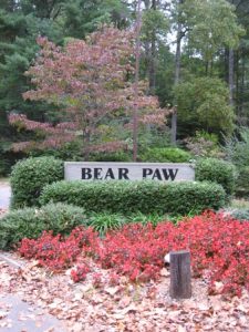
Later that same year, the first 12 cottages were offered for sale. They were located on the right side of Village Road starting near the social pavilion and extending to the entrance of Hiwassee Lake Estates. That entrance was near the intersection of Village Road and Highland Road. You can still see the “Bear Paw” at the intersection, imbedded in the rock face. It’s quite the landmark!

1965 – 589 home sites bad been sold, more than 50% of the available lots. Steps in the development were being finalized to make it a year-round resort. The first phase of the security system was put into effect. Sixteen homes were completed. A model home was constructed at the intersection of Village Road and Lonesome Pine. It is the gray house on the southeast comer. Another model is farther east on Village Road, the “A-frame” cottage on the top of the hill to the left.January 23, 1973 – The resort community became known as “Bear Paw” under the ownership of Dr. Robert Bretches, Errell Steele, Jr., and First Georgia Investment Corporation, a wholly owned subsidiary of Cousins Properties. They wanted to provide for the preservation of the values and amenities of the “Resort” and “Common” properties. “Common properties” were then known as the “Class A Residential Area,” which included the security gates, open spaces, roads and similar facilities. “Resort properties,” included a timber and fieldstone lodge, a gym and a snack shop. Surrounding the lodge were the tennis courts, swimming pool, ice skating rink, and playgrounds. Recreational facilities also included a sled slope, stables, and marina.


Bear Paw of Today


Bear Paw was 1,000 acres of woodland, of which 469 acres were exclusively devoted to privately owned permanent homes. Two hundred and 30 acres were designated specifically for condominiums. December 19, 1973, the lodge burned to the ground and was. subsequently replaced by the present-day clubhouse/office facility.

Today, the Bear Paw community consists of 1,090 lots, over 200 homes, 42 cottages, 23 condominiums and Mountain View Marina. More and more of the friendly people at Bear Paw are permanent residents. They choose to enjoy the services provided year-round, such as security, well-maintained roads and grounds, as well as hiking, fishing and boating. They also enjoy the summer months that are best for swimming and tennis.The Bear Paw community consists of the “Bear Paw Service District,” a special service district ratified by the State of North Carolina, that serves the common properties and the majority of the property owners. A small number of property owners are excluded and are members of the “Hiwassee Lakefront Property Owners Association.” The “Cottage Owners” and the “Condominium Owners” Associations are also excluded. However, both are under contract with the Service District to provide most of the services like security, roads and recreational facilities.


The benefit of the “Bear Paw Service District” is that as a special service district ratified by the State of North Carolina, it levies taxes based on the assessed value of property and homes in the district. A seven member board that is elected by the property owners in the Service District administers the income from the taxes collected by Cherokee County for the Bear Paw Service District. These monies are used exclusively to provide the services of security, roads, grounds and recreation. The Service District helps insure that every property owner shares fairly in keeping Bear Paw, on Lake Hiwassee, a premier private living and vacation community in the beautiful mountains of Western North Carolina.


Bear Paw Downloads

Download the Bear Paw in Murphy NC Current Zoning Ordinance Document (as of 2/9/09)


Need to sell your property in Bear Paw?


Call or email us! It’s a toll-free call at 1-866-687-7496 or email at JohnPoltrock@gmail.com. You’ll receive aFREEcopy of our Seller’s Guide and a market analysis to find out what your property is worth in today’s market!


Want to buy property in Bear Paw?

Call or email us! You can even Search Homes for Sale in Bear Paw right here on our website! It’s a toll-free call at 1-866-687-7496 or email at JohnPoltrock@gmail.com. We’ll immediately send you a list of all the properties in Bear Paw so you can see what is available. We can also notify you the instant new real estate comes available – all for FREE!


The Poltrock Team at RE/MAX –www.iLoveMurphy.comJohnPoltrock@gmail.com – The Poltrock Team – Call usToll Free at 1-866-687-7496for Murphy’s #1 Real Estate Team!


Overview of Murphy, North Carolina – The Location, Population, People, Real Estate, History, and Facts

One of the Entry Signs to Murphy NC City Limits

Murphy is the westernmost town in North Carolina. Nestled in the Blue Ridge and Mountains, Murphy is the county seat of Cherokee County. The city limits of Murphy are actually quite small with a landmass of approximately 1,702.88 acres. On the same token, the “area” of Murphy is quite large. It comprises the entire zip code 28906.

 Location

Murphy’s downtown square is located at Longitude/Latitude N 35 05.267 W 84 02.060. It is located where the Valley River and Hiwassee River come together. Highways 64, 74, and 19/129 are the major roadways.

Directions to Murphy from internet sources such as Rand McNally and MapQuest tend to be down curvy routes.  Although the distance may be shorter, they tend not to be the best – especially coming from our South. You can get the best directions to Murphy NC here.

Population

The city limits of Murphy have a mere 1,568 people. Albeit a small number, if you were to step back and look at the entire area referred to as Murphy (the entire zip code 28906), it has 16,454 people who call these mountains home. All of Cherokee County NC has a total population of 24,298.

The People of Murphy

When you’re looking to move to Murphy or buy an investment and/or second home property, it’s very important to know what to expect from the folks in Murphy.  Locals are some of the kindest and most generous people you’ll meet. They are open to newcomers and don’t shun people. Being in the heart of the Bible Belt, a large portion of people are religious and attend a wide variety of churches with varying denominations. The bottom line is, you’ll meet a lot of people who will become lifelong friends before you know it!

Downtown

A Bird’s Eye View of Downtown Murphy, NC

Downtown Murphy has tons to offer! It’s one of the few downtowns that is walkable and full of great shops! You can easily park your car downtown and walk to every store downtown has to offer. There are many great options that include, and are certainly not limited to, a bakery, quilting shop, auto parts store, hardware and supply, shoe repair and shoe shop, antiques, sporting goods, women’s botique, coffee shop, book store, candy store, furniture store, drug store, and much more. You’ll enjoy it!

Demographics

As of the census in 2000, Murphy was made up of 89.60% white, 5.48% African American, 1.28% Native American, 1.34% Asian, 1.15% from other races, and 1.15% from two or more races. Hispanic or Latino of any race were 2.87% of the population.

Real Estate

Real estate is one thing The POLTROCK TEAM knows well! View many of the common types of real estate for sale here. If you would like for us to search for specific property for you, let us know! You can call toll free at 1-866-Murphy-NC or 1-866-687-7496 or email me at JohnPoltrock@gmail.com . You are also welcome to use our online Contact Us forms.

History

Murphy was named for the North Carolina Politician, Archibald Murphey. Murphy originally started along the trading path known as the Unicoi Turnpike which connected the Cherokee lands east of the mountains with the “Overhill Towns” of Tennessee. Once the Indians were removed in 1836 across the Trail of Tears, the US Army built Fort Butler in what is today Murphy. Fort Butler was used as the main collection point for the Cherokee on the eastern side of the mountains. They were moved from Fort Butler, across the Unicoi Turnpike, and then to Fort Cass (which is now Charleston, Tennessee). Today, the Unicoi Turnpike is better known as Joe Brown Highway.

The site where Murphy is now located at along the Hiwassee River was known to the Cherokee Indians as Tlanusi-yi, which translates to the Leech Place. This name originated from a legend about a giant leech name Tlanusi that lived in the river.

Neat Facts

Murphy is closer to the capitals of six other states than it is its own state capital in Raleigh. The capitals of Georgia, Alabama, Tennessee, South Carolina, Kentucky, and West Virginia are all closer than Raleigh.

Eric Rudolph, the fugitive who was responsible for the 1996 Olympic bombing in Atlanta, GA was arrested in Murphy by the Murphy Police Department after a futile, extensive FBI search. He was found behind Save-a-Lot grocery store.

Murphy, NC is rated by Forbes in the Top 10 list of up and coming vacation home markets.

There’s a rumor, albeit unsubstantiated, that President Lincoln’s Father is buried at the old Harshaw Chapel.

Mark Deweese, All-American Cross Country and Track athlete was both born and played at Murphy High School.

Carl Pickens, legendary football star, is a Murphy prodigy of years past.

Visit the Town of Murphy NC’s Official Website

Written By: John Poltrock, Certified Residential Specialistwww.MyMurphy.comJohnPoltrock@gmail.com – Call us Toll-Free at 1-866-Murphy-NC or 1-866-687-7496

References and Sources
Cherokee County Mapping Department
Wikipedia
The 2000 U.S. Census